Collections Information System and Mapping
Managing Plant Records
Since 2015, Smithsonian Gardens has managed the stewardship of its living collections using the Collections Information System, IrisBG. IrisBG is a complete database and software solution to manage botanical collections and is used by gardens, arboreta, herbaria and private estates around the world.
With IrisBG, Smithsonian Gardens can store images, behind-the-scenes care information, location data, phenology, and descriptive information on every plant in our collection. This system is what powers Smithsonian Gardens’ Plant Explorer, a veritable dictionary of plants and excellent place to take all sorts of themed virtual tours of our collection.
Mapping the Tree Collection
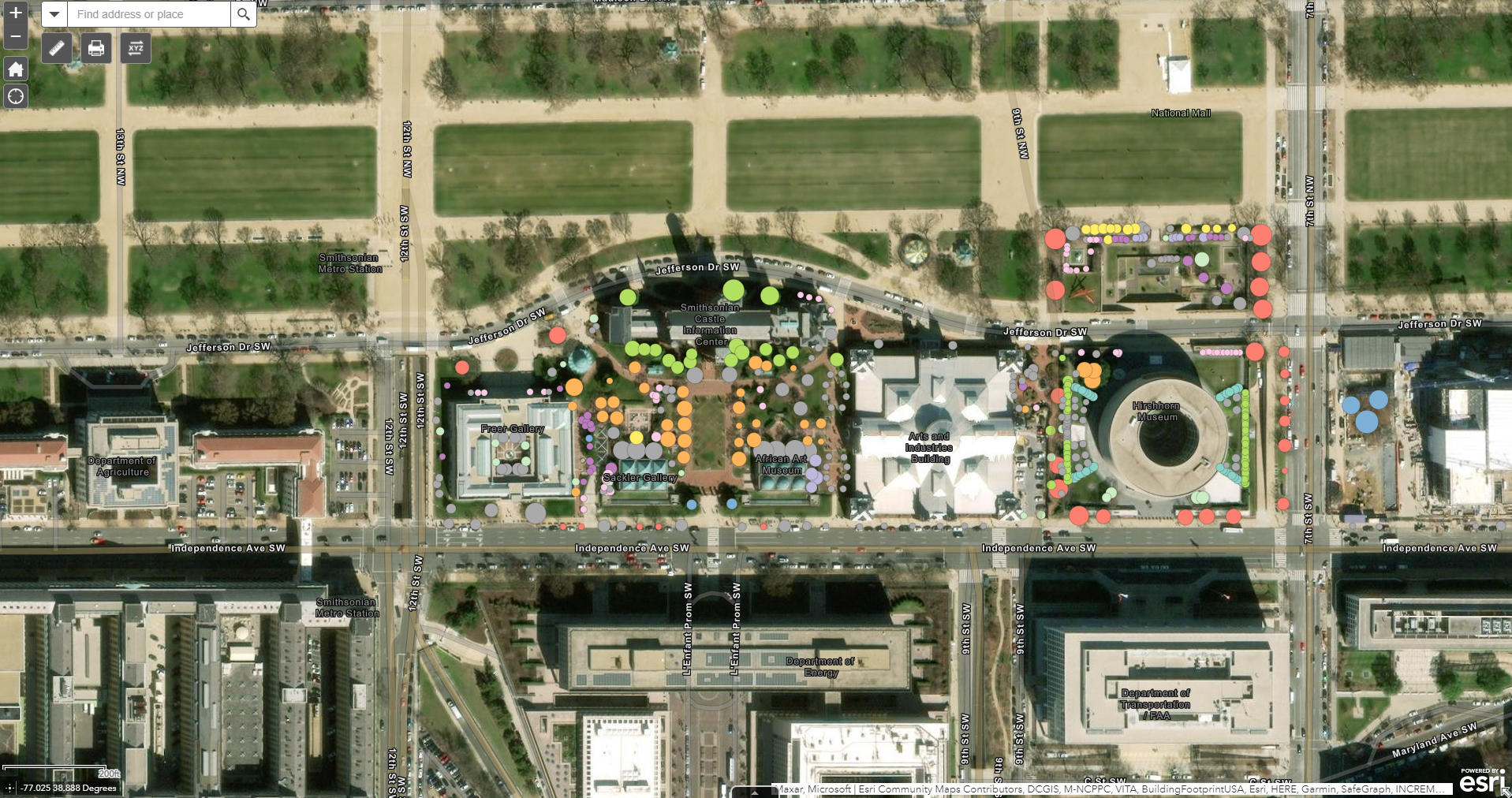
A living tree collection is a spatially dispersed museum collection where a tree’s location is one of its most important attributes to collection managers, horticulturists, scientists, and visitors alike. Smithsonian Gardens utilizes geographic information systems (GIS) software to store and organize an increasingly rich set of information about the accessioned tree specimens, manage the health and condition of these specimens, and serve out information about collection specimens to interested visitors.
Smithsonian Gardens utilizes a well-known proprietary geographic information systems software suite of tools to collect, manage, and maintain mapped data about the collection.
Spatial data about the tree collection is organized using the Public Gardens Data Model developed by the Alliance for Public Gardens GIS and ArcGIS. This robust data schema standardized for use by public gardens has facilitated increased the richness of data about tree collection specimens and increased efficiency of accessing, creating, and updating that data.
Maps of the tree collection are served to users—including the general public—using web browser-based map viewers. The Smithsonian Gardens Plant Explorer application includes a map viewer that provides access to spatial location of each collection specimen in addition to a wealth of information about and access to high-quality digitized images about each taxon represented in the collection.
Explore the interactive Smithsonian Gardens Tree Collections map >
Mapping the Display Collection
Like the Tree Collection, the Smithsonian Gardens Display Collection is spread across SG’s 13 gardens and landscapes located on the National Mall and the Anacostia Community Museum, comprised of over 20,000 perennial and woody plants. As such, it is critical that we use comprehensive tools to manage these records efficiently.
The Display Collection utilizes the same GIS and CIS software as the Tree Collection but contains slightly different information within records that is more relevant to herbaceous and woody perennials. Should a plant be moved from one place to another, or removed entirely, we ensure that the corresponding GIS and CIS records are updated accordingly.
Maps created from these datapoints are also used to indicate whether or not a plant has an incomplete, partially complete, or complete photographic requirement, a key part of our collection management process.
Explore more of the Display Collection on Plant Explorer!
